
Coronaviruses (CoV) are a large family of viruses that cause illness ranging from the common cold to more severe diseases such as Middle East Respiratory Syndrome (MERS-CoV) and Severe Acute Respiratory Syndrome (SARS-CoV). A novel coronavirus (nCoV) is a new strain that has not been previously identified in humans.
Coronaviruses are zoonotic, meaning they are transmitted between animals and people. Detailed investigations found that SARS-CoV was transmitted from civet cats to humans and MERS-CoV from dromedary camels to humans. Several known coronaviruses are circulating in animals that have not yet infected humans.
Common signs of infection include respiratory symptoms, fever, cough, shortness of breath and breathing difficulties. In more severe cases, infection can cause pneumonia, severe acute respiratory syndrome, kidney failure and even death.
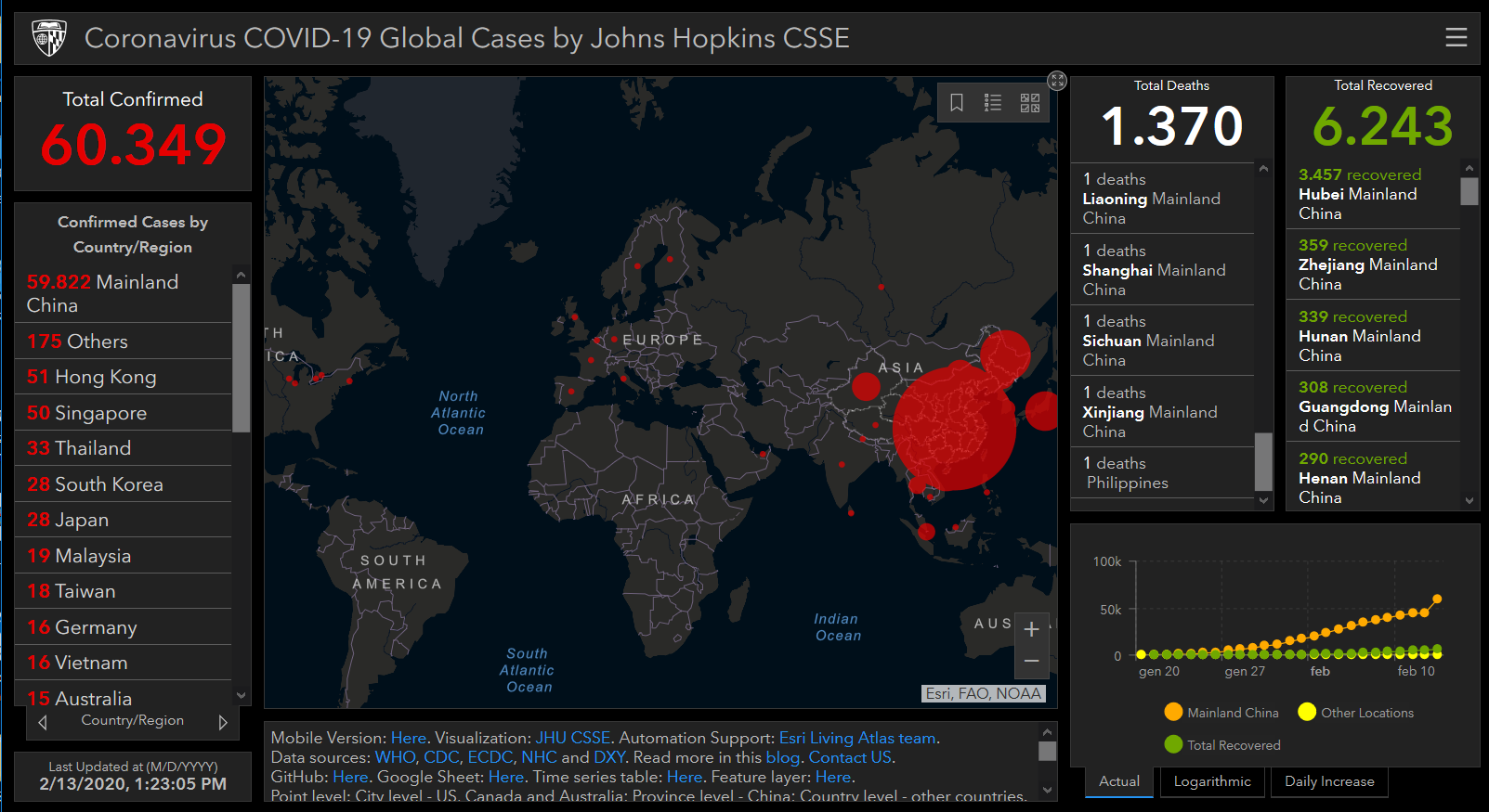
Map updated to 2.13.2020
Check here updates on corona virus (COVID-19) sptread map developed by the John Hopkins University and the Esri ArcGIS Living Atlas of the World: the foremost collection of geographic information from around the globe which includes maps, apps, and data layers to support work.
To learn more
#coronavirus #storymaps #map #bigdata #analysis #health #updates #livingAtlas #Esri #Geosmartcampus #business #accelerator